 Vector Geometry is
important in order to visualize an object (say a computer game character :)
using geometrical shapes, e.g. points, lines, polygons.
As I have learnt, it is also used in the remote sensing... How?
For example, you could display some information (city boundaries, woods, rivers)
as shapes on a map. Or you could "build" your virtual dream-house using
patches as the house's panels, rotate it and see how it fits on your yard.
It is much easier (and faster) to render a patch than a pixel-by-pixel surface!
Vector Geometry is
important in order to visualize an object (say a computer game character :)
using geometrical shapes, e.g. points, lines, polygons.
As I have learnt, it is also used in the remote sensing... How?
For example, you could display some information (city boundaries, woods, rivers)
as shapes on a map. Or you could "build" your virtual dream-house using
patches as the house's panels, rotate it and see how it fits on your yard.
It is much easier (and faster) to render a patch than a pixel-by-pixel surface!
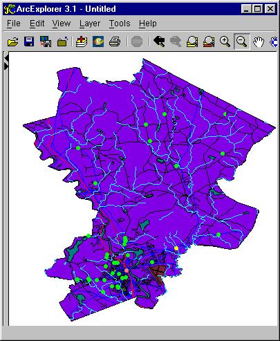
I have done some work on the shapefile formats to handle the GIS data, an example follows:
Compare two panels below - aren't they look similar?
This one is created with ESRI free software ArcExplorer.
and this one I created in matlab,
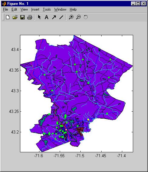 reading the same data files.
Both pictures use the free data provided at
ESRI's web site.