SVETLANA PANASYUK
Medical Hyperspectral Imaging
Optical Metrology
Tissue Spectroscopy
Mantle Flow
GPS
Remote Sensing
Image Processing
Fun
Reference Earth Model
 Sky Map Sky Map
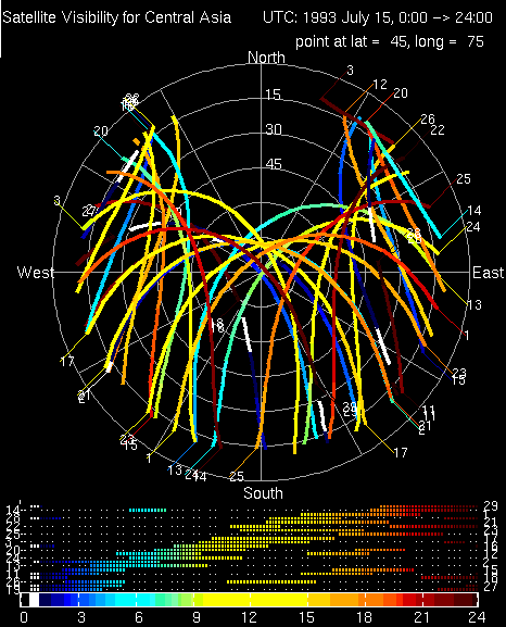
During sessions of our field experiment at least 14 of the GPS satellites were tracked at each station using Trimble 4000 SST or Trimble 4000 SSE receivers which recorded carrier phase data at 30-sec intervals. It is a lot of data to process! But we know: the more, the better. During the observation planning and the data processing, it is usuful to know which satellites, when and where will pass above the antenna. You'd love to know a "sky resolution" that tells you how to mount an antenna to avoid any obstructing structures (mountings/buildings/trees/cows) which might cause additional noise to the data (reflected/refracted signals). I have written a matlab code that creates a "Sky Map" - nice name :) or "Satellite Visibility Chart" for a given point in space (latitude=45 and longitude=75 degrees) and a time-span (July 15, 1993).
This kind of satellite map is easy to build for any place and any time once you have the public-available GPS-satellite data. |
