SVETLANA PANASYUK
Medical Hyperspectral Imaging
Optical Metrology
Tissue Spectroscopy
Mantle Flow
GPS
Remote Sensing
Image Processing
Fun
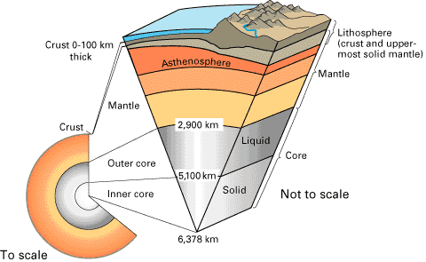
Reference Earth Model
|
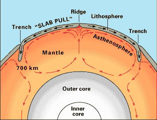
Now, lets see an illustration of "currents" that might exist in the mantle:
Those currents are caused not only by heating from below (core), but also by inner mantle radioactive heating, as well as by a drag occurring due to "slab pull". All of these causes lead to disturbances in the Earth Gravity field, that we can record at the surface.
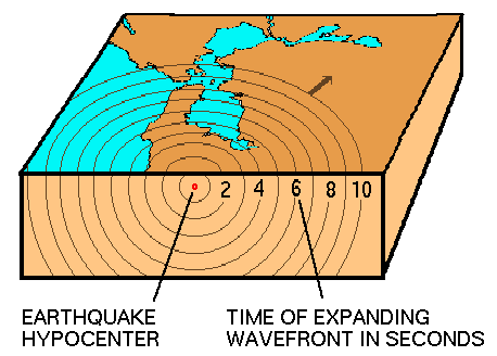
We could trace the plate boundaries by locating places where Earth's crust breaks: locating the earthquakes. Below is a set of images used to analyze seismicity of San Francisco Bay Area.
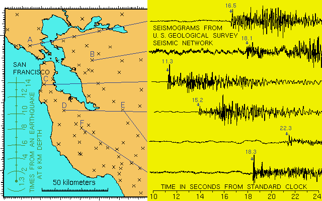
We observe earthquakes with a network of seismometers on the Earth's surface. The ground motion at each seismometer is amplified and recorded electronically at a central recording site. As the wavefront expands from the earthquake, it reaches more distant seismic stations. When an earthquake occurs, we observe the times at which the wavefront passes each station. We must find the unknown earthquake source knowing these wave arrival times. Here is a map of U.S. Geological Survey seismic stations in the San Francisco Bay Area and 6 seismograms from an earthquake.
We want to find the location, depth and origin time of an earthquake whose waves arrive at the times measured on each seismograms. We want a straightforward and general procedure that we can also program in a computer. Part of "Reverse Engineering in Science" lecture, presented by Dr. Svetlana V. Panasyuk on 11 June 2001 at Radcliffe Institute, Harvard University. |
 How Earth works...