SVETLANA PANASYUK
Medical Hyperspectral Imaging
Optical Metrology
Tissue Spectroscopy
Mantle Flow
GPS
Remote Sensing
Image Processing
Fun
Reference Earth Model
|
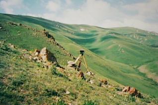
The basic principle of GPS technique is that radio signals originating at satellites and received by a GPS antenna (like one shown in the left photo) make possible an instantaneous determination of the distance between the receiver and satellites. Using a sufficient number of measurements of signals arriving from different directions, the complete vector baseline between two sites can be computed. Because the signal has a known and well-controlled structure, GPS is available for civil scientists. For example, one of many geodetic experiments carried out by the MIT Lab is the measurement of crustal deformation in Central Asia.
Our GPS network covered a part of the Tien Shan where the structure is relatively simple. Ranges and intervening basins trend nearly east-west. Blocks of crust, with east-west dimensions of approximately 100 km or more, constitute ranges that are thrust over other blocks to form basins. North-south dimensions of such blocks of only 20-30 km are comparable to the depths to the more ductile lower crust. A comprehensive study of the velocity field in this region may help to interpret the interconnections of the block movements and the deformation at depth and to understand how the penetration of India into the rest of Eurasia is communicated to the farther North. The initial results of our GPS network are presented in the Nature paper. |
 GPS
GPS